
AutoCAD
Autodesk Autocad 2015-2018 geolocation online map hotfix
BING maps not as current as Google maps when using AutoCAD


It's possible that the higher aerial imagery hasn't been updated or hasn't been captured by the BING team. This is something which is beyond the control of Autodesk.
UTM TO LAT,LONG/LAT,LONG TO UTM CONVERTER TOOL

The Universal Transverse Mercator coordinate system is a global system of grid-based mapping references.
UTM is in fact a set of 60 separate ‘transverse Mercator’ projections,1 covering 60 longitudinal zones each 6° wide. It covers latitudes spanning 80°S to 84°N (the poles are covered by the separate ‘UPS’ system). Latitude/longitude points are converted to eastings and northings measured in metres along (an ellipsoidal model of) the earth’s surface.
UTM
A Universal Transverse Mercator coordinate comprises a zone number, a hemisphere (N/S), an easting and a northing. Eastings are referenced from the central meridian of each zone, & northings from the equator, both in metres. To avoid negative numbers, ‘false eastings’ and ‘false northings’ are used:
- Eastings are measured from 500,000 metres west of the central meridian. Eastings (at the equator) range from 166,021m to 833,978m (the range decreases moving away from the equator); a point on the the central meridian has the value 500,000m.
- In the northern hemisphere, northings are measured from the equator – ranging from 0 at the equator to 9,329,005m at 84°N). In the southern hemisphere they are measured from 10,000,000 metres south of the equator (close to the pole) – ranging from 1,116,915m at 80°S to 10,000,000m at the equator.
Geokov has a good explanation.
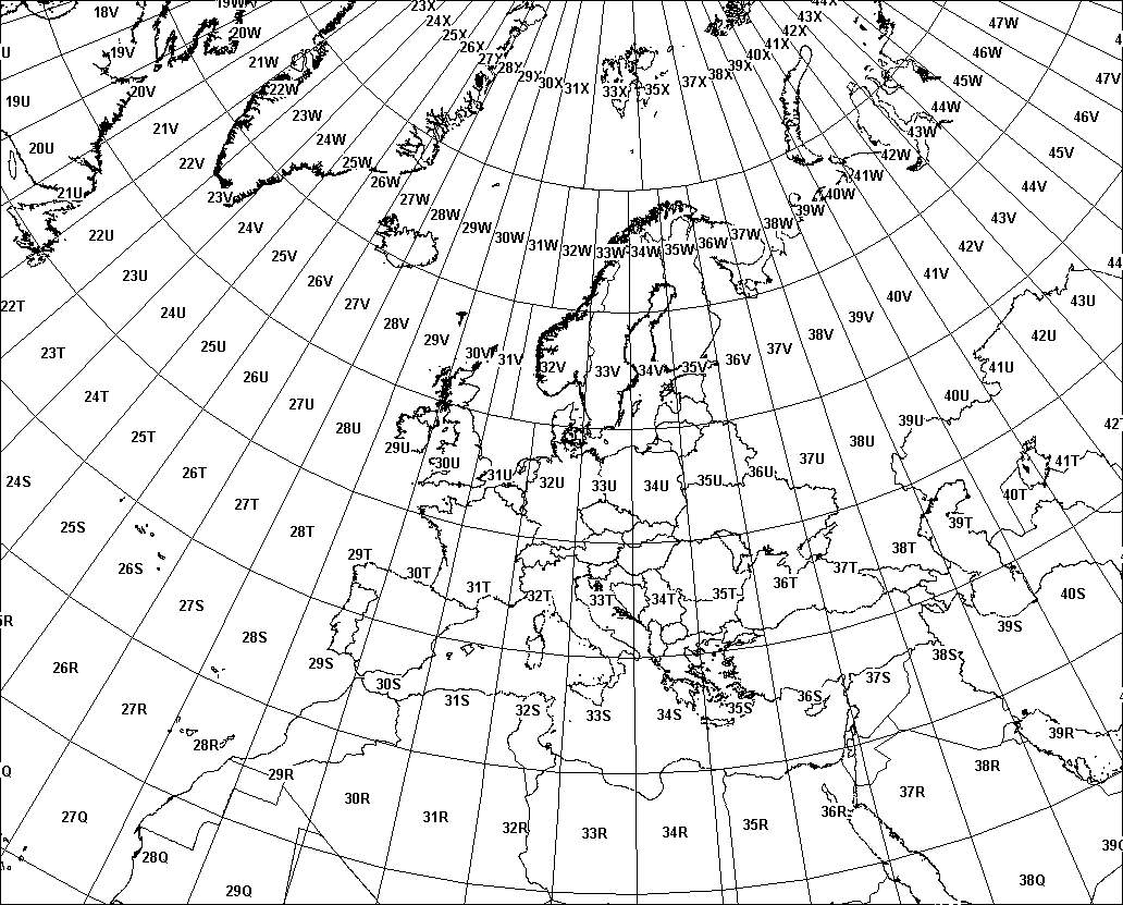
Norway/Svalbard: the designers of UTM made two exceptions to the rule. The part of zone 31 covering western Norway is transferred to zone 32, and the zones covering Svalbard are tweaked to keep Svalbard in two zones (it’s easier to understand looking at a map). These widened zones are viable partly because zones are much narrower so far north, so little precision is lost in merging them.
Note that UTM coordinates get rounded, not truncated (unlike MGRS grid references).


No comments:
Post a Comment